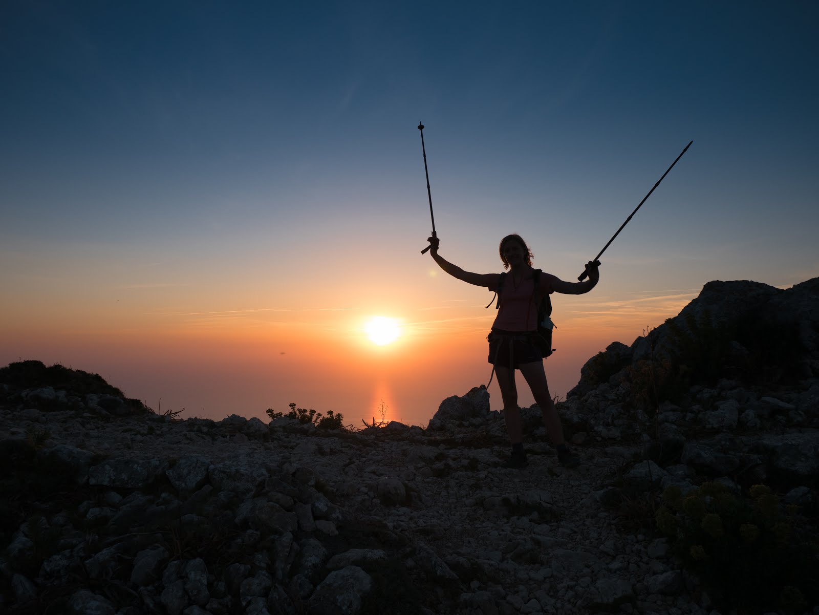
This blog has lain dormant for quite a while. I can't really take any responsibility for that, as I didn't even know it existed until last week, but what I can do is aim to rectify that as of right now! I am Katie's other half (and incidental rambling partner!). We recently took a week to hike the mountainous GR221 - a route that crosses east-west across mountains in the north of Mallorca. There is quite a bit of information out there, and some excellent guidebooks, but during the scope of our (and by our, I mean mainly Katie's) planning it came to light that most of the information is quite old and some new tidbits have since come to light.
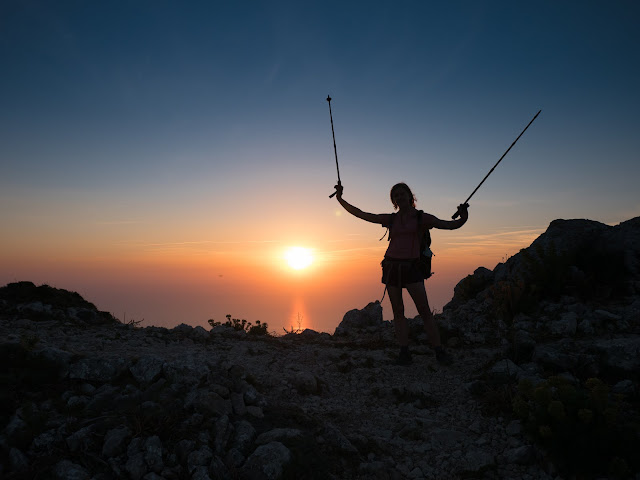 |
Sunset above Valdemossa, day 4
|
General Advice
Trip Planning
When planning this trip I found the following resources helpful:
- Charles Davis: Mallorca's Long Distance Walking Route GR221
- A good guide to have on the trail,with generally easy to follow instructions and still pretty much up to date. His walking times should be taken with a pinch of salt - we were much slower than his estimates. Some people get by with only a guide, especially if they're only walking the marked sections of route, but we also appreciated having a map. I have also heard good reviews of the Paddy Dillon book instead.
- Alpina Serra de Tramuntana maps - 2 double sided waterproof maps covering the whole walk. We found these very helpful when unsure of the guide description and the waterproofing stops them falling about on the second use. There are other maps out there, but we couldn't fault these.
- gr221.info - describes the official stages briefly and outline all the current variations. In theory it should also have updates about the state of the trail. These weren't always reliable, it said the stretch between banyalbufar and estellencs was open, however we found wrapped up markers and notices suggesting that it was still closed.
- www.conselldemallorca.net - the official government site has a good interactive map and you can book refuges online.
- Weekwalks.co.uk - trip report from a couple who have walked it before
- Outdoorsmagic.com - there's a few useful forum threads about how people have done it previously, Paddy Dillon also seems to provide some advice on there.
More logistics
It is very easy to fly to palma de mallorca from most UK airports. From the airport there are good bus links to the rest of the island. To get to the official start in Port d'andtrax take the number 1 bus from the airport to placa d'Espanya (20 mins), then the 102 to port d'andtrax (80 minutes). At the end take the 340 back to palma. If you weren't walking the whole thing or started at one of the variant starts it would still be easy to reach by public transport.
The official walk has 8 stages as is in total 152km/95 miles. Unless you are wild camping it is currently unfeasible to complete the walk in these stages, as the La Trapa refuge is not built and the Coma d'en Vidal refuge is not yet open (although may be opening in 2016). Below I've detailed the distances between places and then facilities in these places to help you plan your route. We did the route in 7 and a half days, we generally had a very long day when bivvying then a shorter day to follow. We discovered several non-government refuges on the way which would make good cheap alternatives to hotels.
To help anyone that is thinking of planning a trip, here is a table of all the places you pass through on the official route. I've given a rough idea of facilities in each place and the distance to the next town/refuge. The towns highlighted in bold are where we found accommodation or at least close to where we bivvyed so you can see how we split the route.
| Place |
Facilities |
Distance
to next place |
| Port d'andtrax |
Hotels, restaurants, supermarket |
8.5km |
| St Elm |
Hotels (Drangonera 70€), restaurants, cafes |
4.5km |
| La Trapa |
Refuge not built, dirty water tanks |
10.5km |
| Ses Fontanelles |
Refuge only - 25€ dorm, private 95€,
drinks, snacks.
www.ses-fontanelles.es |
7.1km |
| Coma d'en Vidal |
Refuge currently closed, well locked |
6.8km |
| Estellenecs |
Hotels, restaurants, cafes |
6.9km |
| Banyalbufar |
Hotels (Baronia 60€) , small shops, restaurants, tap |
8.4km |
| Esporles |
Non-government Refugi Son Trias 14€,
camping, bakery, |
11.6km |
| Valdemossa |
Hotels, restaurants, small shops, bakery, cafes |
15.1km |
| Deia |
Can Boi refuge, small supermarket, restaurants |
11.3km |
| Port d'soller |
Refuge (muleta - 15mins out of town),
hotels, restaurants. Could instead go direct to soller -12.5km from deia |
6.8km |
| Soller |
Hotels, supermarket, bakery, restaurants |
19.5km |
| Tossals verds |
Refuge only - full board advised as no other supplies on
this day. |
16.1km |
| Lluc |
Refuge (Son Amer - 20mins post Lluc). Monastery (60-90€),
cafes |
19km |
| Pollenca |
Refuge Pont Roma, hotels, supermarkets, cafes |
|
 |
| Obligatory gear photo pre-departure |
Accommodation
There are a mixture of options of where to stay on the gr221, The latter few days can be done staying solely in the cheap refuges, otherwise there are options of hotels and wild camping. We opted for a mixture of all three. Should you wish to wild camp there are no shortage of secluded spots not far from the trail, but it is not officially allowed.
The refuges can be booked via the government website, which is good. Less good is the confusion presented by the meal options available - we opted for 'full pension' (dinner, breakfast and picnic) in all of them. The dinners tended to be good, the breakfasts poor, and the picnics somewhere in-between. At refuges in Porto Sóller and Lluc there are options for dinner elsewhere (although you'd need to walk back to the monastery in Lluc), whereas in Tossals Verds there is literally nothing for miles and you need full board. If we did this again, we wouldn't book any food at the Muleta refuge (Port de Sóller) as breakfast/lunch can be found in town. You could also eat out at Lluc, but breakfast and picnic were sensible to have booked. They also seemed able to cater fairly well for vegetarian and gluten free diets in the refuges, if specified on the booking form beforehand. We can't vouch for the quality of the gluten-free food though, as we didn't have any. I would be astonished if there is any provision for vegan food.
Prices
- Dormitory room 11€,
- Dinner (including wine + fruit as dessert) 8€
- Breakfast 4.5€ (tough bread and jam, cheese + ham slices)
- Picnic 6€ (2 sandwiches [serrano ham and cheese], fruit, water)
Water
In June Mallorcan temperatures range from 25-35˚C (for Americans, that is roughly the temperature required to boil an egg on your own face while walking). It feels hotter in direct sunshine. You will sweat buckets, and as such you need to carry buckets. On our coolest day I still drank 2 litres of water, and it was both flat, cool and relatively short. On the hottest day I drank 4.5 litres. Plan to carry slightly more than you will need in case something goes wrong, or do the GR221 when it is slightly cooler. Either one works! We've gone into more detail about where you can find water in the explanation for each day, obviously you can pick up water in every town, but apart from this you may struggle.
Food
We ate in refugios when we stayed in them, and otherwise we ate out in a range of restaurants/cafés ranging from expensive and delicious (1661 in Banyalbufar) to functional and cheap (pizza place in Valdemossa). Breakfasts were most commonly
pain au chocolat, which are heavy on the
chocolat and therefore make for awesome walking food. Second breakfasts were not uncommon. We also ate ice cream at almost every opportunity, and bought baguettes and cheap ham/cheese to make lunch on days we weren't provided with a refugio picnic.
Speak a little of everything - Spanish, English, German...
We ran into huge numbers of German people in the refugios, towns and everywhere else we went on Mallorca, which was somewhat unexpected. As two (relatively) blonde individuals people would frequently assume that we were German. As you would expect on a touristy island, we had no problems with our very minimal Spanish as all hotel staff spoke good English. In general we would start out in Spanish, they would respond in Spanish, we would look bemused and the rest of the conversation would continue in English.
Suncream
Following on from that sun malarkey. We used Riemann p20 SPF 30 all-day suncream, which generally worked pretty well. On the longest days in the least shade, however, when we were sweating firehoses out of every pore and the sun was beating down like the nearby nuclear firestorm that it is, we burnt slightly and should have added a bit more. We had some spare factor 50 'normal' suncream that perhaps should have been used a little more liberally.
Poles
Poles make you look like you take the simple act of walking too seriously, I get it - but if you still want to have knees at the end of the GR221, use them. There is so much ascent/descent that without them you're likely to run into trouble, and nobody likes to cancel a holiday because their joints hurt too much to walk.
 |
| Arrival |
The Walk
Day One - Port d`Andratx to St. Elm (5.4 miles, 2-3 hours)
We started out from Port d`Andratx after catching the bus from Palma airport and stocking up on food/water/ice cream. Ice cream is an important part of any walking trip and the purchasing of it at every opportunity is a solemn duty I take very seriously. In this way, we managed our first ice cream after only slightly more than 200 metres of walking. We also managed to get (slightly) lost within the first two miles - the number of side-tracks, extra trails, and arbitrary cairns is matched only by the overwhelming absence of signposts. With the aid of a map + compass, however, we managed to find our way back to the GR221 without any particular meandering around and down to St Elm. The small town has a resort feel but isn't hugely busy, making it much more pleasant than, for example, Porto Pollença at the other end of the walk.
 |
| The bus leaves and we are boots on the ground. |
Ice creams eaten: 2
Cats discovered: 0
Day One Logistics
- Catch the number 1 bus from Palma airport to the bus station in Palma (change at Plaza España Estacíon), where you can switch to the 102 bus to get to Port d'Andratx. There is also a supermarket in the bus station, which we used to stock up on water, sweets healthy trekking snacks and some disgusting bread (we didn't realise at the time, but never buy round Spanish bread unless it is a baguette unless you like having a dessicated mouth).
- It is very easy to lose the (unmarked) trail after crossing over the hill with the antennae on top. We did exactly this, but just ended up using another path down which rejoined the GR221 slightly further on. There are cairns, but it is confusing.
- In St. Elm we stayed in the Hotel Dragonera, which has no website - e-mail to book. It is a functional hotel in terms of the room (AC is a bonus, absent shower curtain not so much), but provides the best breakfast we had on the whole trip on a terrace with an amazing view.
- Eating out in St. Elm has more options than I could possibly hope to cover here. Pick a place and go for it - many of the menus look pretty similar so I'd go for a place with a view.
Day Two - St Elm to Coma d`en Vidal Refugio (12.5 miles + many, many hours)
Again, for those of you worried about signposting, today was really not that challenging. The only main error we made was right at the start in St. Elm, when we walked in a slightly pointless half-mile loop because we weren't confident enough to keep walking in a straight line when the instructions had told us to. Hiking up to La Trappa monastery (and prospective refugio; being worked on but as yet incomplete) was a hot, steep affair but pleasantly distracting views over the sea and Dragonera island combined with the occasional wisp of breeze made it bearable. La Trappa itself had a
mirador (viewpoint) and various odds and ends to briefly gawp at before continuing. We stopped for lunch at another
mirador further up about 100m off-trail, marked by a cairn the size of a small house.
Meandering on and two days into the walk, we came across the very first official GR221 signpost - an exciting experience marked by much photography and sign-holding. Tragically, the first signpost belongs to a GR221 variant from S'Arraco, and the first official sign was also the last one we saw in a while.
The only other difficulty we had on this day was where the path meets the MA-10. Our maps suggested that there would be a path just before the MA-10, to allow us to avoid walking along the road and we could see a path 200 metres away in the valley. Sadly fairly dense spikey shrubbery decided no to let us past after 50 metres or so and we gave up, with very scratched up legs. A mile or two of not so pleasant road walking followed. Some unofficial signs then guided us to Ses Fontanelles, a new refuge set up by a German couple, that would make a great place to stay if you knew about it beforehand! At this point knew we had been too conservative with water - we had been carrying 4.5 litres each for two long days of walking in the sun - not enough Thankfully the refuge stocked water and soft drinks, if we hadn't found this place we would have arrived in estellenecs very thirsty the next day!
 |
| Estimated timings on the signs varied from supremely long to hopelessly optimistic. |
There was a lot more ascent to come in the form of S'calop, a mountain we all-but-ascended (the trail skips the last 100m or so). Initially we were contemplating wild camping on the plateau just below the summit, but were dissuaded as the evening drew on by hordes of bitey flying things that drove us onwards the last 1.7 miles to the Coma d'en Vidal refugio. Although this remained closed, it did give us a terrace to sleep on and a blissfully fly-free night, disturbed only by the surprisingly-loud baa-ing of sheep and the arrival in the morning of two vanloads of Spanish workers arriving to continue work on the refugio, which has only been under construction for the past 15 years.
Ice creams eaten: 0
Cats discovered: 0
Day Two Logistics
- As we were hiking for two days we were carrying 5 litres of water each. As it happens, this was nowhere near enough and we were fortunate enough to discover the unmarked (on our map) Ses Fontanelles refugio selling 2-litre bottles of water for €1 each. Grabbing an extra two litres each was just the ticket. If you had water filtration equipment (some of which is very portable) there is also water accessible at La Trappa from the fire storage reservoir, but this did not look palatable in any way without treatment. There was no water available at the Coma d'en Vidal refugio and the well was padlocked.
- Route finding was difficult up the S'calop; there are lots of trees down but the cairns generally do not lead you astray, provided you keep a good ye out for them. Once you get to the far west corner it is easy to be deceived into descending - don't. Instead look upslope for a cairn marking a path to a gully full of downed trees. You an work your way through these and then get up on to the ridge, which gives great views.
- We wild-camped (tsk tsk) but had we known of the existence of Ses Fontanelles we would likely have stayed there instead. If we were to do it again, we'd just call it a day at Ses Fontanelles, carry less water, make the ascent easier and have a slightly longer day the next day instead. Alternatively, if the Coma d'en Vidal refugio ever opens you could go there, but that has been a work in progress for the past 15 years and still, in true Spanish style, remains unfinished. There are rumours of a 2016 opening, but I'll believe it when I see it.
Day Three - Coma d'en Vidal to Banyalbufar (8.7 miles, 4 hours)
This was basically a half-day after the rather long and water-laden day two. The walking was easy and predominantly descent down to estellenecs - a small town with a few cafes. We made good progress up to the border of the de Rafal estate along lovely wooded paths. This particular estate has been the topic of much legal wrangling over the past ten years after the (ashamed they are a countryman) British owner decided that they did not want anybody walking the ancient right of way that exists over the land. It has now been agreed in the courts that a centuries-old footpath trumps expat arrogance and de Rafal estate section will be open for business shortly.*

However, when we arrived there was a sign blocking the route and we were forced to walk along the coastal road instead, described by the guide as having 'no merits'. This is patently false, as the road is one long mirador with amazing cliffs on one side and glorious sea views on the other, with the tourist site of the Torré del Verger (below) en route. There is a lot of crossing the road as it is pretty sinuous. If you decide to climb the Torré del Verger I would recommend leaving your bag at the bottom - the exit at the top of the ladder is pretty cramped!
 |
| Torré del Verger |
Ice creams eaten: 2
Cats found: 3 (but none especially sociable)
*Spanish time nonwithstanding.
Day Three Logistics
- Water sources: water (marked not potable - filters/treated only) at bottom of Coma d'en Vidal descent road. Just up the road if you do not go through de Rafal estate is a large font which would again need treatment/filtration. There is a water tap in Banyalbufar just past the turn-off for the GR221 up the hill in town (and next to the general store, where wonderful baked goods are to be found in the morning).
- Path generally well marked up today. de Rafal estate still had signs saying closed
and official signs were covered, hence our decision to go down the road. The map showed some paths on the coastal side of the road but despite our best efforts we could not identify these and they may have lapsed.
- We stayed in Hotel Baronia, which had a pool (very nice) and a terrace (nice) but was quite noisy and without AC so our room was quite hot. Breakfast was to be €9 so instead we went to the general store in the morning and got the best pain au chocolat we had on the whole holiday. I would recommend you do the same.
- Food: We ate dinner in the 1661 restaurant, with a polyglot maître d' and excellent food (although it was not cheap. Totally recommended though, and try the almond ice cream at the end). We also ate lunch the day before in the café on the way in to Banyalbufar (Torré de Verger direction) which was easy on the wallet and the taste buds.
Day Four - Banyalbufar to Valdemossa (and a bit extra. 16.8 miles, ~12 hours inc. meals)
Finding the way out of Banyalbufar was easy, although the subsequent steep ascent is both unshaded and on the road, making for a positively sauna-like experience. Ascending, we overtook a group of 4 Germans. "Large groups move more slowly - unlikely to see them again" said I, as we crossed on to the wonderful shaded path through the woods at the top of the hill en route to Esporles.
Esporles itself was a fairly sizeable town, although it might only have felt that way because the GR path goes directly to the high street from the woods and then directly out again. Eating ice-cream on a bench and having made lunch from the (excellent) bakery we see the Germans go past us to a nearby café. We wave. We are comfortably ahead. We leave on the long, slow, gentle ascent out.
Nice shelters, but the start of our first wayfinding error
The woods above Esporles are full of both
sitjes (charcoal burning circles) and old bread ovens. What the woods above Esporles are not full of is signposts. Pathfinding once you get on to the high plateau is challenging and we managed to get ourselves lost, finding a descent path that after much consultation of the map and brandishing of the compass we realised would take us down too far west. We ended up firing up the GPS on my phone and marking a direct co-ordinate waypoint, then bushwhacking the 100m or so to where we needed to be. En route, we did find a spectacular viewpoint so it was not entirely futile. Crossing the col we came upon (who'd've guessed?!) the Germans sitting and having a drink. They, apparently, did not get lost. Eager to make up for lost time we cracked on.
 |
| High-quality signage on the plateau. This was pretty much the best one - most of them were painted dots faded by age, or stones arranged into an arrow shape. |
Descending into Valdemossa we once again managed to get turned about, although I'm still not sure how it happened. We ended up coming into Valdemossa via a slightly different route, but nonetheless went directly there without any further bushwhacking or bearing-taking. We ended up in part of an outdoor museum, about two minutes from Valdemossa centre. Bad pathfinding, but excellent result.
Valdemossa was reasonably large compared to most places we'd come through thus far. Around the museum were a lot of cafés. We debated long and hard over the description of these - I proferred the 'cheap + touristy' line whereas Katie opted for 'simple'. We settled on 'functional'. Picking a random functional café, we ran into the Germans. Curse their efficiency!
After a
cheap functional pizza we bought the obligatory ice cream, a pastry known only as the Chocolate Triángulo for breakfast the next day, and stocked up on water before reluctantly donning bags and heading up into the mountains once again. A couple of hours of ascent later the slightly gloomy woods (more down to the hour than the woods) yielded to mountaintop scrub - we summited the peak for sunset, then walked back the way we'd come a short way and picked a lovely sheltered bivvy under a tree for the night.
 |
| Room with a view. |
|
Ice creams eaten: 2
Cats found: 0
Day Four Logistics
- There are no good water sources on the path along the course of today, although we did find some very stagnant water in a cistern next to the path up on the plateau. That would probably be a filter + chlorine/boiling job if you were desperate.
- Pathfinding on the plateau is not simple - much of it looks the same and we depended heavily on the guidebook and the map/compass to identify our location. Do not get distracted by cisterns/
sitjes/bread ovens and mind the path - there are many distracting trails. However, we lost only an hour or so and we didn't try too hard, so don't let this put you off provided you know how to use a map/compass. Leaving Valdemossa, you come across three 'Itinerary' trails, all of which are signposted the wrong way. Just walk straight up the mountain along the track and you will reach both a picnic spot and eventually a government refugio, for which you need keys. However, there is a lean-to shelter next to it, should you want to stay there without keys. There is also the one and only GR sign on the whole ascent scribbled in marker pen on a portaloo.
 |
The mirador above the col on the plateau
|
Day Five - Deià (ish)-Porto Sóller
'Start your day as you mean to continue it' is an excellent philosophy, which is why on day five I started my day watching the sunrise from atop a mountain while eating a giant chocolate pastry. We got up around 6am to catch the sunrise for breakfast before cracking on down the long, wooded descent into Deià. The path on top of the mountain here I think is one of the standout parts of the whole GR221 route, and it's a shame that so many people choose to start/finish in Deià and miss out. Don't be one of those people!
 |
| The Chocolato Triángulo in all its glory. |
That being said, the last mile into Deià before joining the road was the worst piece of (passable) path we saw on the whole route. It is very, very overgrown and barely visible in places (but with no chance of getting lost, because the undergrowth off-path is so very, very dense). More reason for it to be walked more.
Deià was described in the guidebook as having a first language of English, and that was certainly our experience. We were greeted by cheerful 'good mornings' on the way down into town, reaching the amazingly-stocked supermarket (tiny, but selling
all of the things) around 8am for second breakfast. What did we have for second breakfast? Well, all I shall say is that there is no limit to the quantity of pain au chocolat it is permitted to have per day while doing long distance walking. Walking out of Deià we
again saw one of the Germans from day four (there is
no way that he could ever have caught us on foot - we concluded that he must have taken the bus) but that was truly the last we saw of them.
The path from Deià to Sóller is a veritable motorway of walkers. It is relatively flat, broad and signposted to the hilt. I would say that it is basically impossible to go wrong, except that we hadn't quite realised that Sóller and Port de Sóller were actually geographically quite separate and the path divides. We spotted the issue, however, and made it to the Port de Sóller refugio (Refuge Muleta) in good time. You can see the silvered dome of the lighthouse next to the refugio for some distance away and the refugio itself has excellent views over the town and out to the west for over-sea sunsets.
 |
| Sunrise from the Muleta refugio. Sunset is more spectacular but is tragically without lighthouse. |
Heading down into Port de Sóller proper took about 15-20 minutes walk down the road and Katie took the opportunity to have a dip in the sea before using the (excellent) shower in the refugio. The sleeping arrangements in the Muleta refuge are a single gigantic dorm room with about 40 beds in it. Sit and hope there isn't a snorer in the room. We were not so lucky.
Ice creams eaten: 1
Cats found: 2
 |
| The refugio cat (one of two) |
Day Five Logistics
- Water can be acquired in the supermarket in Deià and in Port de Sóller. There is no other easy location to get it, but these two places are fairly close together so not to worry.
- Breakfast in the refugio was at 8am and was distinctly average. That is a very late start so you can't avoid the heat and not really worth it - do what we should have done get food in town. Walk down the road (ignoring the GR221 signs) to the port, get food, then rejoin the GR221 about five minutes walk through town on the other side. Saves you doubling back, lets you start early, and gets you a proper breakfast. If you are going to eat refugio bread for breakfast, do yourself a favour and carry some Nutella to make it more palatable!
- Dinner in the refugio was reasonable (but didn't hold a candle to the other two we stayed in) but there are lots of options for eating out in town, including an expensive looking restaurant right next to the refugio if you are so minded. I think if we were to come through again we might eat out just for the change.
 |
| This might look ok, but believe me when I say the only halfway-decent bit is the orange juice. |
Day Six - Port de Sóller to Tossals Verds (16.6 miles, ~9 hours inc. stops)
We'd not realised quite how long today was going to be until we spoke to another walker, going the other way, who said she had walked 27km and had gotten in around 7pm after taking the tram from Sóller to the coast. Luckily, breakfast at the Muleta refugio was no later than 07:30 and we were on the road by 08:00 to make some headway. We cheated a little (to avoid walking back the way we'd come to get back to the path junction where we turned off for Porto Sóller) and walked down the road to the port and rejoined the GR221 on the other side of town, which shortened the day slightly and saved us repeating ourselves. It was a brutally hot day (the hottest of the trip) and also, coincidentally, the day with the most ascent of the entire walk. Fortunately, we did find some random water sources to soak t-shirts in to stay cooler, although even this did not help massively on the very, very long ascent up to the reservoir. The path winds on through Sóller to the village of Biniaraix, where we found a mini torrente by the side of the street full of freezing water, and huge fields of tempting oranges (all of which are just out of reach). From there onwards begins what I lovingly referred to as the Endless Stair - 2000 steps ascending around 900m vertical height over a couple of miles. Our guide was very true when it advised that we would be confronted by streams of 'sprightly septogenarians' springing down the mountain as we slogged upwards (apparently they get dropped at the top and only have to walk down.) You then get to the top, only to be confronted by EVEN MORE ASCENT. It was brutal, and I definitely found it the toughest day of the walk despite Katie seeming to dance up it.
 |
| The reservoir from the other end, looking back. |
From the top, once you have reached the other end of the valley (which is very nice, but offers no shade - today is the day I burnt a bit despite the suncream) you are presented with two options: continue on the GR221 standard route or take the Pas de Llis variant, which is steeper (down) and shorter. There is also (shock horror) a small section of the Pas de Llis which has a steel chain to help you climb it, although this remains very unchallenging and is easily managed even carrying poles in one hand. Do not allow this to put you off! The path is rugged and the going slow, although the scenery is very nice and using this prevents you having to retrace your footsteps the next day, which is good for morale. Do not trust the time on the signpost, which is hopelessly optimistic - the variant took us about about two and a half hours rather than the '1hr 50' advertised.
 |
| The Pas de Llis chained section. Not that steep, but a great addition. |
At the end of a very long day, getting in to the refuge (there is free wi-fi) and showering before being served a pretty lucsious dinner is exactly what you need, and exactly what we got. Amazing food (slow-roasted chicken and potatoes with salad) and a smaller dorm than the night before (albeit one that was still warmer than the surface of the sun). The refugio cat (every refuge must have a cat!)is also very enthusaistic friendly and comes well recommended if you are a cat lover.
 |
| The refuge. |
Ice creams had: 0
Cats found: 1
Day Six Logistics
- There are two taps on the way up the endless stair which provide water, although I can not attest to whether it is potable or not (same goes for the reservoir). There is also the streetside stream in Bainiraix.
- There is literally nothing around the Tossals Verds refuge, so unless you are carrying your own food there is no merit in not taking the 'full pension' option when booking.
The Pas de Llis route is an accepted variant of the main GR221. If you decide to follow the main route, it is longer but flatter by comparison. The official route also means doubling back on yourself when you leave the Tossals Verds refuge the next morning.
Day Seven - Tossals Verds to Lluc (Son Amer refuge) -
After the savage ascent of yesterday, today felt pretty chilled. Indeed, initially the path wanders through shaded, non-rocky woods and there was even a stream. This might not sound that impressive, but barring the sea and an artificially-created reservoir it was the first open water we'd seen on the whole trek.
 |
| Fisheye on the ridge |
Leaving the woods, we crested the col on the highest ascendable mountain on the island (the actual highest one is closed off for military use and is made obvious by the big radar dome on top). From here we could see the end of the walk in the distance. There is not much shade on this section of the walk from when you leave the woods on, so be ready!
 |
| The descent down towards Lluc |
Coming in to Lluc you are confronted by a sign offering cold drinks. This comes at a time that you really would like a cold drink, and we fell for it hook, line and sinker. Around five minutes walk later, you get into Lluc proper, which consists of some cafés, a monastery, and a substantial car park. Importantly, you can get ice cream here before going on to the refuge, a short walk away. The refuge itself is in a more recently-refurbished building than the others, complete with an actual computer at reception and more free wi-fi. The initial strong showing, however, was heavily let down by the drippy trickle of water that passed for a shower.
Ice creams eaten: 1
Cats found: 1
Day Seven Logistics
- No water is available between Tossals Verds and Lluc.
- There are some cafés/restaurants by the monastery in Lluc, approximately ten minutes walk from the refuge. This would be an option if you wanted to eat out that evening, although the refugio evening food was, as usual, excellent.
Day Eight - Lluc to Pollença
We started the day a little unusually by being followed by the refugio cat for a good half-mile. Initially funny, this became increasingly worrying as we became paranoid about our effective abduction of the cat by paying it too much attention the day before. She did eventually lose interest and retreat back down the path, but it took a while.
 |
| The pleasant bit of the walk down from Lluc. |
The day itself was fairly uninspiring - after a long and slow descent through some woods the path flattens out and meanders casually alongside the road into Pollença. You don't need to walk on the road at any point except for a very brief bridge crossing, although the path does run alongside it at points. A section of the path marked as being in poor condition is, in reality, absolutely fine.
The last day feels very much like a slow drift back into civilisation. Helped by cloudy skies and end-of-holiday feeling the eighth day was easily my least-favourite of the walk. At least Pollença is a redeeming feature - a lovely Spanish town with a gigantic staircase in the centre leading up to a church. At the bottom of the staircase you can get Valls ice creams, which are amazing and well-worth the €2-3 investment. Following a short wander about the town centre we caught the bus to Porto Pollença and our hotel for the last night.
 |
| The Pollença staircase |
Port de Pollença is a wildly different place to pretty much every other place we visited on the island. A heavily-touristed resort town, it scores very highly on our newly-invested 'Resort Bingo' game (scorers include lobster-red white people, Irish bars, the presence of a seafront Burger King and being apologised to in English by a clearly Spanish family). On the positive side, the hotel was cheap and there were an indecently wide range of places to eat - we went to a tapas bar, then wandered the seafront until the sun went down.
Day Eight Logistics
- There isn't much to say about today - you walk in a relatively straight line until you reach Pollença. There is a refugio in Pollença if you wanted to stay there on finishing.
- We caught the bus from Pollença to Porto Pollença - looking at the map, there was no clear way you could walk it except on large roads. Buses between the two are frequent (although they had come down to hourly on Saturday).
- Getting from Porto Pollença to Palma to fly out is a single bus ride. The bus station has moved from the clearly bus-station-looking building on the seafront to a random layby behind some hotels. This is, however, signed and is not too difficult to find. The bus back to Palma on Sunday was exceptionally busy as people try to get to the market in Pollença, so make sure that you get to the Palma bus earlier - tell the driver you are going to Palma rather than Pollença and you will hopefully get prioritised. We did, so you can too.
In summary...
That's it! Our entire, encapsulated experience of the GR221 end-to-end walk. This is a glorious path to walk, covering as it does the mountains to the sea and tracing a path through a variety of small Spanish towns and villages along what is, in general, a well-maintained path. In true Spanish fashion the path remains incomplete decades after its inception, but don't let that put you off - this is a very worthwhile experience and one which will stay with us for years to come.
Feel free to post any questions in the comments. Thanks for reading!